Detached, generally dense clouds and with sharp outlines that develop vertically in the form of rising mounds, domes, or towers with bulging upper parts often resembling a cauliflower. The sunlit parts of these clouds are mostly brilliant white while their bases are relatively dark and horizontal. Over land, cumulus develops on days of clear skies due diurnal convection. It appears in the morning, grows, and then more or less dissolves again toward evening.
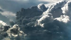
The thunderstorm cloud, this is a heavy and dense cloud in the form of a mountain or huge tower. The upper portion is usually smoothed, fibrous, or striated and nearly always flattened in the shape of an anvil or vast plume. Under the base of this cloud, which is often very dark, there are commonly low ragged clouds that may or may not merge with the base. They produce precipitation, which sometimes is in the form of virga. Cumulonimbus clouds also produce hail and tornadoes.
Gray or whitish patchy, sheet, or layered clouds that almost always have dark tessellations (honeycomb appearance), rounded masses, or rolls. Except for virga, they are non-fibrous and may or may not be merged. They also have regularly arranged small elements with an apparent width of more than five degrees (three fingers at arm's length).
A generally grey cloud layer with a uniform base which may, if thick enough, produce drizzle, ice prisms, or snow grains. When the sun is visible through this cloud, its outline is clearly discernible. Often, when a layer of stratus breaks up and dissipates, blue sky is seen. Sometimes appearing as ragged sheets, stratus clouds do not produce a halo phenomenon except, occasionally, at very low temperatures.